Local Voices for Sustainability
How Athens is using AI to detect and fight forest fires
Montag, 13. April 2026 · 24 min
Kapitelklicken springt direkt hin
Shownotes
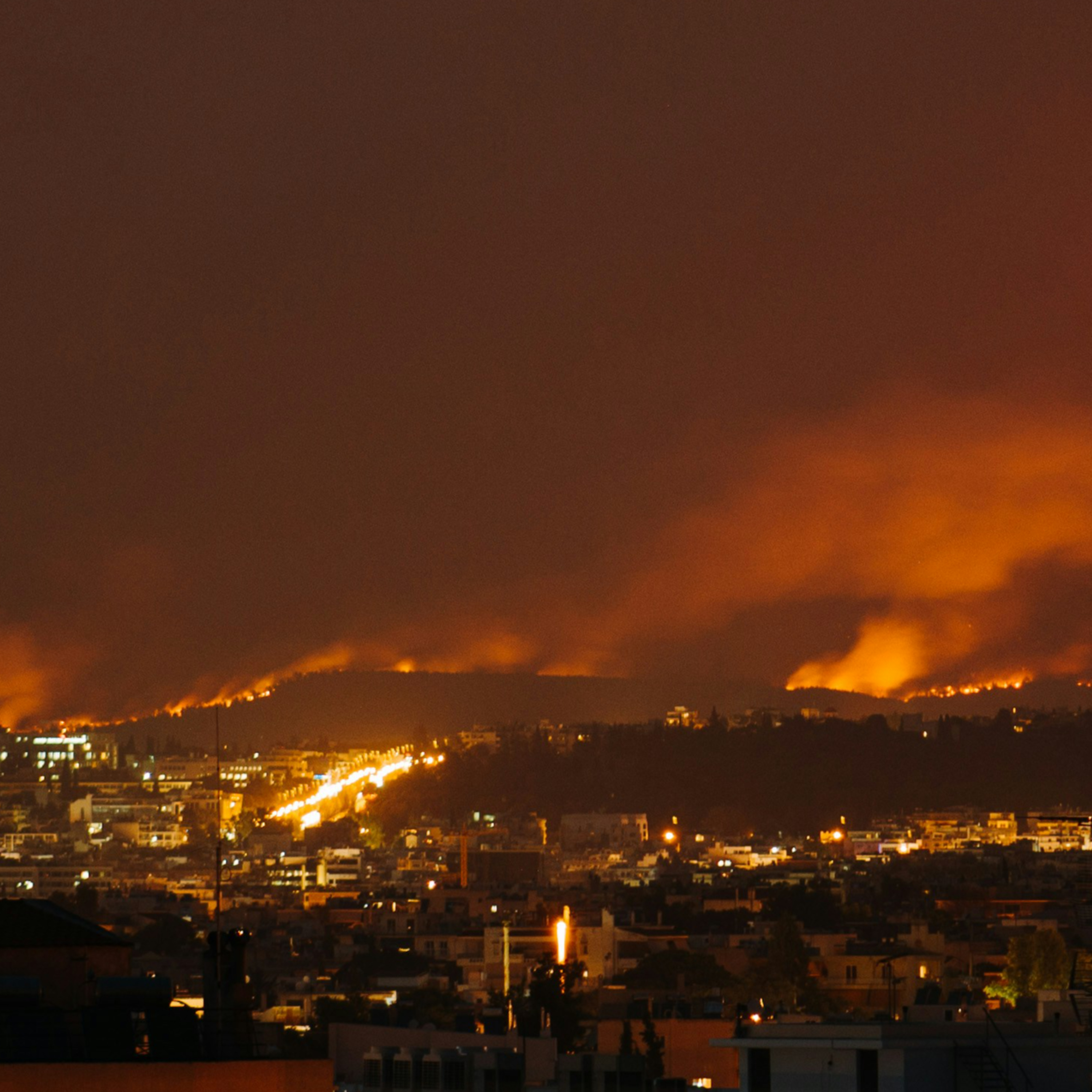
As heatwaves intensify and wildfire risks grow, cities on the urban-forest edge face mounting climate pressure. In this episode, we head to Athens to explore how data, AI and collaboration help the city detect wildfire threats before flames appear.
Vangelis Marinakis from the National Technical University of Athens and Lina Magoula from the National and Kapodistrian University of Athens take us inside the DRYADS project (dryads.scanlab.gr), where environmental data, smart monitoring and research partnerships come together to strengthen forest resilience and protect nearby neighbourhoods.
Transkriptvom Podcast bereitgestellt · Zeitmarken springen hin
Hello and welcome to Local Voices for Sustainability. I'm your host, Laura Schubert. In each episode of this podcast, we explore the sustainability challenges and solutions emerging in E Clay member cities across Europe. Today we're heading to Athens, Greece, a city that has found itself on the front lines of climate change.
The Greek capital is experiencing more frequent heat waves, worsening air quality and increasing wildfire risks, particularly in the forested areas surrounding the city. So our central question today is how can cities use data, technology and collaboration to better prepare for climate driven risks like wildfires? To explore this, we're joined by two experts working at the intersection of research, technology and city climate action.
First, Vangelis Marinakis, assistant professor at the School of Electrical and Computer Engineering at the National Technical University of Athens, and 2nd Lena Magula, senior researcher at the Department of Informatics and Telecommunications at the National and Capo Distrian Universities of Athens. Lena Vangelis, Nice to have you both here. Nice to join this very interesting podcast. Thank you, Laura.
Have to participate in this interesting discussion. So let's jump right in with you, Evangelis. Athens is often highlighted as a city that is particularly exposed to the impacts of climate change because of its climate, geography and dense urban environment. From your perspective working with the city, what are the main climate and sustainability challenges Athens is facing today? The city is currently facing three major challenges. First, heat waves.
There is a clear rise in both the frequency and intensity of extreme heat events. In the past, the city record approximately 5 to 7 heat wave days per year. Today that number has increased to around 15 to 20 days and according to climate projections, we could face 30 or more extreme heat days each year by mid century.
The second major challenge is air quality. During winter, for instance, fine particulate pollution levels rise mainly due to residential heating, while during the summer period, high temperatures combined with traffic emissions lead to higher levels of air pollution. The third challenge, of course, is wildfire risk.
Athens is surrounded by forest mountains like Pendeli Parnitha, which are increasingly affected by drought and extreme heat. Even within the city, some hills and green areas are becoming more vulnerable to fires. So to summarize, the three issues you mentioned are an increase in the frequency and intensity of heat waves, air quality and wildfire risk, Is that correct? Exactly.
So today's sustainability in Athens means something very concrete, protecting citizens from heat stress, improving air quality, reducing climate related risks, and strengthening the resilience of both urban and surrounding natural systems. As these climate pressures grow, Athens has also started developing new ways to respond. For example, the city has appointed Europe's first chief heat officer.
How is Athens currently approaching climate action, and what role are data, technology and citizen engagement playing in that effort? The city has launched A dynamic program of small and medium scale interventions to improve micro climatic conditions. For instance, since 2024, more than 11,000 new trees have been planted across the city, with an ambitious target of 5000 trees per year.
OK, wow. The city create the first urban micro forest in Kipseli, redevelop public squares using cool materials and introduce new cooling gardens like in Serafio campus with pergolas, natural materials and misting systems. So measurements from several interventions show that surface temperatures can be reduced by 4 to 6° in some cases even more.
In Botanicos we are implementing now the largest urban regeneration project in Balkans region, where we are creating a new green area together with two stadiums. It will be 1 1/2 times larger than the national garden and will include nature based solutions like rain gardens through which rain water will be redirected.
And do you have any examples of citizen engagement taking place in Athens? I think Athens is now not only developing digital tools but also try to build participation around them. For instance, through the Youth Climate Action Fund, the city support climate initiatives led by young people. Through the 15 Minutes neighborhood approach, residents Co design improvements in the local areas. Also a number of hackathons to enable SMEs, startups, students to exploit data and develop new data-driven services for Athens. In the city.
Also, there is a big smart cities program where we are enabling the installation of meters. Environmental sensors in buildings, neighborhoods show improving energy monitoring, air quality tracking, waste management and more. The city also establish A dedicated support structures like energy poverty alleviation office as part of a previous European project Power pool, promote also photovoltaic installations, energy systems in schools, public buildings, often working together with students, citizens to Co design solutions using all these data and new technologies like in the Ascent Super Block initiative.
So the direction I think it's clear, more data, informed actions, more green infrastructure, more active involvement of residents. All these are important in order to create a climate resilient Athens. One of the projects working to address climate risks in Greece is Dryads, which focuses on strengthening forest resilience and improving wildfire detection.
The project brings together researchers, public authorities, and new monitoring technologies to better understand wildfire risk. Lena, can you explain for us what the DRYADS project is and how it is helping to improve wildfire detection and prevention? Of course, Dryads is a project we are developing through the Clay action Fan Breeze, and it focuses on improving how we detect and manage wildfire risk. The platform essentially acts as a wildfire risk intelligence and early detection system designed to help authorities detect fires earlier, understand where risk is increasing, and respond faster before a fire becomes uncontrollable. In welfare management, those first minutes are extremely important.
In many years, if a fire is detected and contained within about 15 minutes, it can be prevented from turning into a large scale wildfire. But after that point, especially during heat waves or strong winds, a small ignition can spread very rapidly. Wow, OK, so that really requires a fast response then, right? Yes, yes, yes.
So what Dryads does is that we support this early response time window by continuously analysing different types of environmental information. We combine data from centres that measure things like temperature, humidity and wind together with weather forecasts, satellite observations and information about vegetation and terrain.
Using artificial intelligence and machine learning, the system looks for patterns that might indicate that the fire has started or that conditions are becoming particularly dangerous. For example, if sensors detect a sudden temperature increase in a very dry forest area, and this aligns with strong winds and satellite signals showing some hit anomalies, the platform can generate an early alert so authorities can investigate quickly. Another important aspect of the platform is identifying risks before a fire starts.
So can you give an example of such a pattern that would indicate that a fire might start? Dryads can detect things like waste accumulation in natural areas, which may not sound obvious but can actually be a serious hazard. Materials like plastics or dry organic waste can act as ignition points or help a fire spread faster. So by identifying these areas early, authorities can prioritize clean up actions before the fire session begins. OK.
And the system also includes what we call a digital twin, which is essentially a virtual replica of the real environment. It allows us to simulate how fires might behave under different environmental conditions. And this means authorities can test scenarios such as extreme heat or strong winds and see how a fire could potentially spread in a specific area when prior on historical information is not available for this area. And that helps with preparedness, a better planning from the relevant and responsible entities. And at the same time, the goal of our project is not just to produce complex technical outputs. Firefighters and civil protection authorities need information that is clear and
actionable. So the platform presents risk levels on maps, highlights and usual events, and provides confidence indicators so decision makers can understand how reliable an alert is. And the system is also continuously validated with real events and unfilled data, so that over time it becomes more accurate and more useful for operational decision making. So from the way that I understand it, a central feature of Dryads is the way that it combines different types of environmental information with artificial intelligence to assess wildfire risk.
Bringing together these different data streams can help build a much clearer picture of how and where fires may start or spread. Lena, can you describe for us what kinds of data feed into the Dryads platform and how are those data used to predict and assess wildfire risk? That is a very critical question, especially if we are talking about intelligent applications.
Wildfires are actually influenced by many different factors, so predicting them requires combining several types of information. At the environmental level, let's say the platform collects sensor measurements such as the temperature, the humidity, and wind speed, and these variables directly affect how easily vegetation can ignite and how quickly a fire might spread. For example, low humidity with high temperatures and strong winds can create particularly dangerous conditions for a fire to get uncontrollable.
Also, meteorological data are very important information for our system because the system uses weather forecasts and indicators such as heat waves or drought conditions to understand how risk may evolve over the coming hours or days. And in Greece, prolonged heat waves combined with strong seasonal winds like the Miltoni can significantly increase this wildfire risk. Another key component is the geospatial information. The platform incorporates data about the land cover, vegetation density, the range, slope and elevation, and these factors influence how fires behave and how quickly they can spread across a landscape.
For example, a fire that starts on a steep hillside can move much faster uphill, especially when strong winds are present, which makes that area significantly more difficult to control. OK, so many different things are being monitored constantly, from the weather to vegetation density and elevation. Yes, and try and also analyzes real time video streams for both fixed and moving cameras, For example cameras that are installed on drones.
And this enables our AI models and the system to detect early signs of smoke or fire in this video feeds. And at the same time, the camera help identify any waste accumulation and estimate the concentration of different materials in the area monitored, which is important because certain waste deposits can increase the ignition risk or accelerate the fire spread. Right, OK.
Finally, the satellite data provide another layer of information because Earth observation imagery helps monitor the vegetation conditions, the surface temperatures and also past fire activity, which is very useful for training and improving the predictive models. And the system is continuously validated during real fire sessions where sensor measurements confirm the environmental conditions on the ground.
The satellite data allow cross checking of detected events and reports from the civil protection units or citizens. Observations help verify what actually happened. And by comparing predictions with real outcomes, the models are regularly updated and retrained so the system can adapt to changing climate condition and evolving wildfire patterns. OK.
And for my last question, before we head into the second segment of our show, I would like to look to the future. As wildfires become a growing challenge across Europe, many cities and regions are looking for tools that can help them prepare and respond more effectively. Projects like Dryads raise the question of how digital solutions developed in one place might support climate resilience elsewhere. So, looking ahead, how could the Dryads platform be adapted for other regions?
And how might the tools developed through the project support Athens long term climate goals? I'd like to hear from both of you on this one. Vangelis, why don't we hear from you first? Schools like drades could support cities like Athens maybe in three ways. First, as early warning monitoring layer for urban hills, very urban areas, broader metropolitan areas. Second, as a data integration environment that combine all this data that Lena mentioned before. 3rd, as a bridge between climate adaptation, civil protection and smart city governance.
Especially considering that Athens is already investing in digital transformation projects with sensors, monitoring systems, municipal data and more. So next step is to see how we can move for from a pilot oriented approach to operational approach by adopting solutions like triades in municipal workflows and coordination with other relevant civil protection activities.
And Lena, perhaps you could add something about the app's potential for expansion beyond Athens. Yes, Dryads. I would firstly like to highlight that it is designed, since the beginning of the project, to be transferable to different regions, because wildfires occur in many parts of the world, but each region has its own landscape, climate conditions and the governance structures. So for that reason, our system is built in a modular way, meaning that the different components, the data sources, the predictive models that we use along with the operational tools can be adapted without the need of redesigning the whole system.
So from the Athens of city, the data level, the platform can integrate the different local information and our machine learning models can be adapted so they can reflect the specific environmental conditions of the area, whether that involves the Mediterranean ecosystems, mountainous terrain or other type of landscapes inside. Of course, also in our digital trains and in terms of infrastructure, the requirements are relatively straightforward. The the Dryads is focused on information already available to relevant authorities, such as the weather services, the satellite information and the local monitoring systems like sensors or cameras.
And through our replication interface, the systems where the system will be linked with the civil protection teams so that when an alert or risk warning appears, it can quickly reach the people responsible for responding on the ground. So overall, our modular design makes Dryads a system that can be easily connected and adapting to different landscapes and municipalities, and we hope this also applies for Athens City.
Mm hmm. So this brings us to the second segment of our show, which we call Hot Takes. We're going to turn up to speed a little bit with these next questions. I am looking for a brief instinctual response. Ready. Mm Hmm. Yeah. OK, Lena, let's start with you. What's the ideal response time to contain a wildfire before it becomes a major event?
The 1st 15 minutes are the most critical ones in case of a wildfire detection. We need to provide some forecasts in the 1st 2:00 to 3:00 minutes in order to have a better view and to allocate the resources before these things get really out of control. Vangelis besides firefighters. Who else is involved when a wildfire breaks out near Athens?
I think there is a coordination between the relevant Ministry for Civil Protection, the region, the article region governance and the municipalities affected by these wildfires. So there are different level of governance, national, regional, local, which need to be coordinated in order to support the relevant actions for the wildfires. Lena What's the coolest place to be in Athens during a heat wave? Training heat wave, I think in the metro stations where we have a low decrease for sure because during especially the fire season, the hotel is the most experienced thing in not only in Athens and but also in the Greek islands. OK, so out of the city.
Yeah, yeah, yeah. Lena, if you had more time on the Dryads project, what would you want to expand or explore next? I would like to test our our complete project, let's say to different landscapes to test the the project outcomes. If some policies that are followed by our AI models could also adapt and evolve in different in different areas with different terrains and different characteristics because we will test this in the variable of municipality as a first pilot case.
But we want to adopt and enable our system to be faster and give more decisions and guidance to the relevant authorities that will be very helpful in this critical times. So we need to, let's say, advance our AI models to be more autonomous in their decision making by enhancing their intelligence in different conditions and landscapes beyond even Greece. And Vangelis, our last question for you, what's one key insight you would share with other cities dealing with wildfire risks?
Based on the discussion till now, I think it's also important to mention Copernicus, which are major European initiatives to create platforms with satellite data. For instance, in Greece, many times when we have a wildfire, we contact Copernicus to be able to monitor the square meters with wildfires. And that's it.
We've reached the end of our show. Lena and Vangelis, thank you both so much for joining us. This has been an illuminating conversation. I think if you don't live near a place that typically experiences wildfire, this is a climatic challenge that can somehow feel remote. But you've both brought this issue to life for us today, so thank you.
Thank you for inviting us in this very fascinating podcast. Thank you, Laura. Thank you for all the coordination and the fruitful discussion. And to our listeners, if you're curious to learn more about the Dryads project or about wildfire prevention, particularly in urban spaces, check out our show notes.
That's all for now. Thanks for joining us and until next time.